About Us
A new trail, running east to west across north central Vermont.
Following the Winooski River and Wells River valleys.
- family friendly recreation for people of all ages and abilities
- safe travel to school and work for non-motorized commuters
- convenient location for daily exercise and healthy outdoor activity
- a permanent greenway for easy local access to the natural world
The Cross Vermont Trail will be a 90 mile path connecting towns across the state from Lake Champlain to the Connecticut River - over 30 miles are built and open to the public, and more are under construction now.
The Cross Vermont Trail Association is a formal organization of people who want to help make this trail complete. We are an incorporated non profit, 501(c)(3), member based and volunteer driven, with two part time staff members.
Our purpose is to assist municipalities, recreation groups, and landowners in the creation and management of a four-season, multi-use trail across the state of Vermont for public recreation, alternative transportation, and awareness of our natural and cultural heritage.
The Cross Vermont Trail Association was created when people saw these needs:
Some local towns and landowners are building shorter trails, but they lack connection to each other. We answer the need for a statewide organization to support the connection of existing trails into a complete network.
Some local towns and landowners are interested in having trails in their area, but lack the resources for construction on their own. We answer the need for a non-profit organization that can raise funds and recruit volunteer effort to help build new trails from scratch.
And in the meantime, we answer the need for "getting people past the Bike Route End signs". We are creating, installing, and maintaining signs and maps. These guide travelers on the best roads that string together existing pieces of path to put together longer trips.
The trail is a work in progress!
Bit by bit - we are working with willing landowners who want to sell or donate property to make the trail corridor, and then we are leading actual trail building with volunteers, youth groups, and (where needed) skilled contractors.
We are also coordinating with and supporting (and applauding!) the ongoing trailbuilding efforts by many other trail groups, municipalities, and state agencies.
Signs are up along the length of the statewide route. Maps and guidebook are posted online. Have you been out along the route lately? Tell us how things look to you.
It's overdue.
That's right, we're making real the vision
of Trails for All Americans:
"What would it take for all Americans to be able to go out their front doors and within fifteen minutes be on trails that wind through their cities, towns or villages and brings them back without retracing steps? Along the way they could pass shops and restaurants, go to work, school or a park, visit an historic site or the zoo, and experience the great outdoors without a car or bus. If they were to follow the right path, the trail could take them into the countryside or possibly link up with another trail that would lead them into the deepest wilderness or to the highest mountain or across the widest prairie. They could travel across America on trails that connect one community to another and stretch from coast to coast, and from border to border. Such a network of trails was endorsed in 1987 by the President's Commission on Americans Outdoors when it called for a nationwide system of greenways within easy access of all Americans."
Read the original:
Report of the National Trails Agenda Project; submitted Summer, 1990. (opens as PDF 1.3 MB)
A short history of the Association's work to date:
The Cross Vermont Trail begins with a big idea, the idea of a continuous trail through the Winooski River and Wells River valleys that is not one built path, but a route formed by connecting local community trails to span the entire width of Vermont. Cross Vermont Trail Association (CVTA) celebrates local trails and highlights them as part of a statewide route, while leading the creation of new trails to make critical links and a complete network.
The Cross Vermont Trail was launched in 1992 by trail enthusiasts from across the state who recognized they had a shared vision and saw a wider association as a way to address common needs.
The 1990s were a time of broad outreach and exploration. An ad hoc collection of volunteers started it all off literally at a kitchen table. They carried out public surveys, convened community meetings, pored over maps, and organized group bike trips and walks to find the best potential trail corridor. Opportunities were identified, but challenges were also clear, such as the barriers created by I-91 in Wells River and the Winooski River in East Montpelier. In these years, the first miles of Cross Vermont Trail were designated; most significantly the old railbed in Groton State Forest was saved from being broken up and became officially a rail trail.
Success as an independent organization able to take initiative and lead big endeavors. In 1999, the Cross Vermont Trail Association (CVTA) incorporated as an independent non-profit, and hired an Executive Director. Though partnerships are a key part of how we work, the independence of CVTA is the ingredient that makes it possible for us to achieve our vision. We were founded to be a member based, charitable group governed by a volunteer Board of Directors. Currently, hundreds of people each year are counted as members when they donate or volunteer.
Steady growth of accomplishments over twenty years. We started with a bang in 2003, building a trail underpass beneath I-91. Then we moved our focus to the even larger job of a bridge over the Winooski River, now built! In 2005 we closed on our first permanent easement conserving a portion of trail corridor, and have continued to secure trail rights-of-way and purchase land steadily ever since, from landowners interested in supporting the trail. As of 2008 a complete statewide route was established with signs and detailed maps showing local trails and how to link them together with the best available roads. At the start, nearly half was off road trail or quiet roads, but the remainder was still on busier highways. Let's fix that! In the 2020s CVTA continues its steady work to promote, improve and extend local trails and we remain excited about the future.
About Our TrailWhat inspired the idea for the trail? Where is the Cross Vermont Trail? What can you do on the trail? State and National Recognitions. |
 |
|
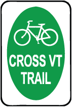
| Route sign identifies on-road sections and urban "Shared Use Paths". |
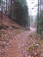
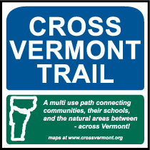
Trail sign marks simple path sections. |
What inspired the Cross Vermont Trail?
Many local trail groups and municipalities are already building shorter trails. We are inspired by the idea to connect community trails together and create a continuous statewide network.
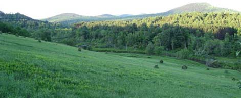
River valleys form natural corridor for a long distance east to west trail at this latitude. The western half of the route is made possible by the unique geology of the Winooski River as it originates to the east of the Green Mountains, then flows through a narrow 3,700 foot deep valley carved between Camels Hump and Bolton Mountain to Lake Champlain. This water gap creates a natural east to west corridor across the state, with a gradual grade even through the mountains. (We're not the first to notice this. Central Vt Railroad, US Rte 2, and I-89 all use this gap. It is still a peaceful, rural area.) To the east, the Wells River picks up over the divide from the Winooski headwaters and flows the opposite direction to the Connecticut River, providing another gradual river valley to follow.
A historic railroad exists that can be converted to a trail in places. The eastern half of the route, from Montpelier to Wells River, is galvanized by the possibility of using significant portions of a historic railroad bed. From 1873-1956, this railroad hauled granite, lumber, mail, milk, school kids and livestock. The railroad generally followed the most gradual possible route, paralleling the upper part of the Winooski River and then following the entire length of the Wells River. Many miles of the old railbed are currently open as public trail. Other parts are not open for public use. And some portions of the old railbed could be open to the public in the future, but are fallen to disrepair and not useable in their current state. What does remain are the towns along the length of the old rails, still connected by a natural corridor that can again host an invaluable means of recreation and alternative transportation.
Studies of other long distance trails over the years have documented trails can have a positive impact on economic activity and increase home values in their communities. (Some of these studies are catalogued online at Rails to Trails Conservancy.)
Because it's fun, and healthy, to get outside and ride, run, glide, stroll along a trail that starts near your house and goes and goes. It may be 20 minutes with the dog after work, it may be riding your bike to school, it may be a state wide journey of exploration.
Where is the Cross Vermont Trail?
Statewide summary: From the west, the trail route begins in Burlington on the shores of Lake Champlain, then generally parallels the Winooski River through Waterbury and Montpelier to the town of Marshfield, where it crosses out of the Winooski watershed in Groton State Forest. Meeting with the head waters of the Wells River in the State Forest, the trail continues along the length of the Wells River through the villages of Groton, South Ryegate, and Wells River to the east end at the Connecticut River.
Another way to visualize the general route of the trail is to look at a Vermont Highway map. From west to east, the route of the Cross Vermont Trail generally parallels Rte 2, Rte 232, and Rte 302.
In Burlington, South Burlington, and Williston, the trail route mostly follows the excellent municipal bike path networks created by these communities. They have worked many years to develop this network. An alternative route, including some more primitive sections open only to foot traffic, can be composed from the string of parks maintained along the banks of the Winooski River by the Winooski Valley Park District and Burlington City Parks.
In Richmond, Bolton, Waterbury, Moretown, Berlin, and Middlesex our route is formed by a patch work of recreation paths, quiet dirt roads, and scenic stretches of Rte 2 and Rte 100B.
In Montpelier we join with the Montpelier "Siboinebi" Bike Path, which now goes all the way across the City east to west. This paved municipal path is a "rail - with - trail" and that runs beside the still active railroad between Montpelier and Barre.
In East Montpelier Cross Vermont Trail Association is working now to create an off road path extending the Montpelier Bike Path up to U-32 School and on across East Montpelier to where the rail trail begins by Route 14. This is a big project, and new sections of trail are opening each year. Check back for updates!
Finally, starting at the eastern part of East Montpelier and running through Plainfield, Marshfield, Groton, Ryegate, Newbury, and Wells River the trail route alternates between open sections of path created from the historic railbed of the old Montpelier - Wells River Railroad and sections of Rte 2 and Rte 302. CVTA is working towards the long term goal of moving the entire route off of state highways. In some places this can be achieved by repairing portions of the old railroad. In other places the old railbed is not available and we are talking with interested landowners about alternative corridors where we can build new path from scratch.
What can you do on the Cross Vermont Trail?
Our mission is to build a four season, non-motorized, multi-use trail.
Bicycling. Essentially all designated portions of the Cross Vermont Trail are useable by ordinary bikes. (Some short spots may easier to dismount and walk through - sometimes that's the price to get the route connected all the way through.) Any reasonably solid bike with medium sized tires will do. (You do not need a high performance mountain bike, but a skinny tire road bike will find it rough going.) Biking is one of our basic rules of thumb - if it works for bikes, then it works as the Cross Vermont Trail.
Hiking, dog walking, baby strolling. The entire route is open to foot traffic. The trails are wide and gradual, so they are convenient for young and old alike. Dogs (under the immediate control of their owners) are welcome on all the open trail segments.
Equestrian.The trail through Groton State Forest is a destination for equestions, who use it to link with many other trails in the State Forest to make long off road rides.
You name it. Over the length of the statewide route, the trail takes many forms. Opportunities for all kinds of trail users are available at different locations.
(Whether or not there is also motorized use on a trail segment is a decision made by the land owner. If the land owner allows motorized use, and if a motorized user group wants a trail there, then CVTA partners with them to share the work of caring for the trail. We currently work together with several local snowmobile clubs.)
Get out in Winter! Most trail segments are open in winter. Maintenance varies from groomed snowmobile trail, to plowed municipal paths, to places where you just tromp through the deep snow.
Get out in Spring! Many recreation trails in Vermont are closed in the spring, because of wet conditions. However, Cross Vermont Trail segments tend to be thoroughly constructed, with good drainage and firm treadway, even where they pass through woods and nature areas. As a result, we are more likely to open sooner in the spring for those who want to get out on trails when it is still "mud season" elsewhere.
Universally Accessible. The Cross Vermont Trail is a great chance to build long stretches of real trail that meet Americans With Disabilities Act Accessibility Guidelines and run for miles, taking users from town centers on out through dramatic terrain and into open natural areas. The "ADAAG" guidelines for recreation trails are pretty straightforward. Essentially, the trail has to be gradual, several feet wide, with a smooth, stable tread. We're excited to make a true long distance accessible trail!
State and National Recognitions.
The Cross Vermont Trail has qualified for listing as a member of the Vermont Trails System and as a National Recreation Trail. Designations recognize the merit of the work we are doing, and documents that this work meets certain standards.
The Cross Vermont Trail Association is a private, non-profit corporation. Because the state wide route is a patchwork of many different pieces, we work with a wide variety of partners - including private landowners who choose to allow a trail on their land, as well as many local towns, and also State and Federal agencies.
Vermont Trails System
On May 21, 1996, the Cross Vermont Trail was designated by Governor Howard Dean as a part of the Vermont Trails System. The Vermont Trails System was created in 1993;
"In order to provide access to the use and enjoyment of the outdoor areas of Vermont, to conserve and use the natural resources of this state for healthful and recreational purposes, and to provide transportation from one place to another, it is declared to be the policy of this state to provide the means for maintaining and improving a network of trails to be known as the "Vermont trails system." It is the intent of the legislature that trails be established within and without boundaries of state parks and forests and, when feasible, to interconnect . . . " (Vermont Statutes, Title 10, Chapter 20, § 441)
One important aspect of the Vermont Trails System law is an emphasis on liability protection for private landowners who allow designated trails, such as the Cross Vt Trail, on their land.
National Recreation Trail
On June 3, 2003, Gale Norton, United States Secretary of the Interior, designated the Cross Vermont Trail as a National Recreation Trail. The National Trail System Act of 1968 authorized creation of a national trail system comprised of National Recreation Trails, National Scenic Trails and National Historic Trails. While National Scenic Trails and National Historic Trails may only be designated by an act of Congress, National Recreation Trails may be designated by the Secretary of Interior to recognize exemplary trails of local and regional significance in response to an application from the trail's managing organization. Through designation, these trails are recognized as part of America's national system of trails. The goal of which is to promote the use and care of existing trails and stimulate the development of new trails to create a national network of trails and realize the vision of "Trails for All Americans."