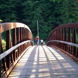
Getting Ready to head out!
First Day Hike; January 1, 2012.
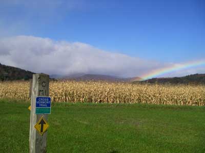
Looking forward to 2012.
2011 turned out to be quite a year for trails, as it was for many people. The historic floods of both May and August directly impacted our trail. Most of the trail was reopened by Fall 2011, and in 2012 we will be working to not only finish repairs, but to improve all existing sections of trail to be more sustainable as well as more inviting to users. In addition, we are working together with interested land owners to establish right of way for many miles new trail at locations across the state, including what will be a watershed project in the history of the Cross Vermont Trail, a new 200 foot bridge over the Winooski River in East Montpelier.
Residents of all towns through which the trail route passes are invited to get involved in the CVTA. Right now we are seeking to establish an active membership in every town. Contact us anytime to learn more.
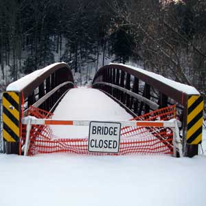
Bridge posted closed on Montpelier Bike Path.
December, 2011.
But is predicted to be open next summer
after repair by City of Montpelier.
Oops, back the other way again.
The bike bridge in Montpelier, between Taylor Street and Bailey Avenue, is closed until further notice. This is the portion of the Cross Vermont Trail route shown on (Map 6). Announcement of closure location from the City posted here (PDF 191KB). It sounds like some of the steel structure has rusted out on the bridge. Speculation says that the rust was a reaction of the steel with the treated decking and with the salt used to keep the treadway clear in the winter. In any case, the City of Montpelier Public Works are currently planning a repair in the coming year. In the mean time, an alternate route for Cross Vermont Trail followers is:
- WESTBOUND: stay on Taylor Street, using the sidewalk on the historic truss bridge over the Winooski, then follow the sidewalk along Memorial Drive west to where it rejoins the bike path.
- EASTBOUND: where the bikepath turns away from Memorial Drive onto the (closed) bridge, stay straight on the sidewalk beside Memorial Drive, to the Taylor Street bridge and back onto the Cross Vermont route.
UPDATE June 2012: And indeed the bridge is repaired, open again, and looks great!
Flood Updates 8/30/2011
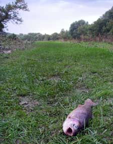
Fish sees receding of flood water
from a different perspective.
(On trail in Waterbury.)
The historic flooding of May 2011, and now hurricane Irene, have impacted the route of the Cross Vermont Trail in numerous places. Here is the latest information we have. If you have updated information to pass along, please call or email us.
Information is listed East to West. First for trails, then for roads.
TRAIL SECTIONS
- The Cross Vermont Trail in the Newbury Conservation area, behind Blue Mt School and on either side of I-91, is OK. Also in this area are the Blue Mountain Nature Trail and the Boldtonville Nature Trail. They may have been impacted by flood, contact us if you have information. (Map 1)
- The trail on the railbed in the Town of Groton, between Pine Mountain and Rickers Mill, is in OK shape. Note that the Valley Grill in Groton, which offers trailhead parking, was severely impacted by flooding. They looked like they we were already starting to rebuild on August 30. We wish them the best! (Maps 2 and 3)
- The trail on the railbed in Groton State Forest between Rickers Mill and Lanesboro was severely damaged in May, and was repaired by the State Forest in August. We believe damage from Irene was minimal. If you bike through this section and see any sections that have been redamaged, let us know. (Map 3)
- The trail on the railbed between Country Club Road in Plainfield and Rte 14 in East Montpelier is cut in two. There is a major washout where an old railroad culvert failed, about half way between the two roads. More information here. Contact us if you are interested in learning more or are interested in helping to fix it! The trail leading up to the washout from Country Club Road is OK. The trail from Rte 14 east to the washout has several slumps and smaller impacted areas. (Map 5)
- The path in the City of Montpelier is OK. (Map 6)
- The bike/ped bridge over the Mad River on Lovers Lane in Moretown appears to be OK. However, there were obvious flood impacts to the banks, near the bridge. There may be repair work ongoing. Use caution, heed any posted warnings. (Map 7)
- Best to stay clear of the trail along Winooski River in Waterbury, while clean up of the State office buildings and hospital is in progress. The trail behind the state office buildings in Waterbury and leading over to the Hope Cemetery, was inundated with flood waters and has some potholing and debris on it now. (Map 8)
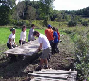
- The Johnnie Brook Trail is Richmond is CLOSED for repair. Call if you would like to help! Flood waters damaged the decking of bridge over the brook, and also a section of boardwalk. (Map 10)
- Bike paths in Williston are OK. (Map 10,11,12)
- Bike paths in South Burlington are OK. (Map 12)
- Champlain Parkway Path and Oakledge Park in Burlington are OK. (Map 12)
ROAD SECTIONS
- Creamery Road in Ryegate is CLOSED for repair. The alternate route for the Cross Vermont Trail is continue on Rte 302. (Map 2)
- The town roads in Marshfield between Lanesboro and Rte 2 (including a portion of the railbed) have not yet been reviewed by us. Please contact us if you have current information. (Map 3)
- All other roads along the Cross Vermont Trail route are open as of 8/30/2011. However, there is flood impact all along the route, so stay alert for repair work in progress, and for posted notices of current conditions.