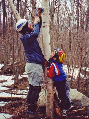
 Seth Coffey drives the golden spike on the first Cross Vermont Trail sign. (With audience.)
Trail Blazing
Signs and how to find the Cross Vermont Trail.
1. Use Maps, Cue Sheets and written guide material (in addition to signs).
Navigate the route by combining signs with maps, cue sheets, and written guide material. There are hundreds of signs statewide, but also long stretches between them. It may be difficult to follow the route using signs as the only source of information.
2. What the signs look like.
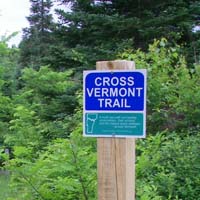
Trail Sign.
The current standard "trail sign"
marks the route on simple path sections.
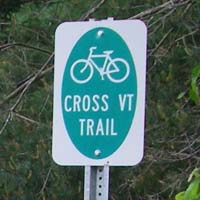
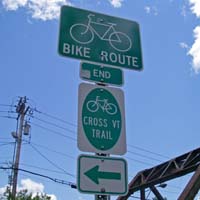
Route Sign.
The current standard "route sign"
marks the way on roads and on urban Shared Use Paths.
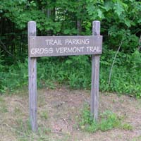
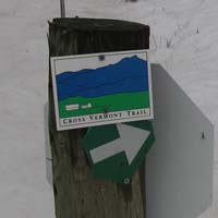
Sundry Cross Vermont signs.
You will also find a variety of other signs along the trail route. Unique signs have been made for some particular spots (such as trailheads). Also, if a previous version of a standard sign is still working, it may not have been replaced yet with the current version.
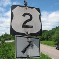
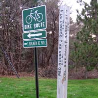
Signs for coaligned routes.
When the Cross Vermont Trail is coaligned with another route that has its own signage system, expect fewer Cross Vermont Trail signs. On these stretches, we "pass the baton" and rely on the other route's existing signs to mark the way. There will be occasional Cross Vermont Trail signs for "reassurance," but for primary wayfinding look for the local signage. Examples: following a long stretch of Rte 2; following a long stretch of the South Burlington Rec Path.
3. Signs clarify the route at significant turns and other "decision points".
Signs may be before, at, or just beyond the turn or decision point.
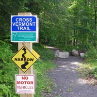 Before decision point
 (a chicane),
saying "yes, proceed."
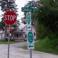 At decision point
(intersection of
two town roads.)
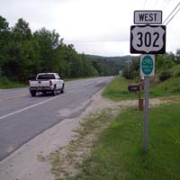 Beyond decision point
(where path segment has ended at road shoulder), beckoning the correct way.
Unfortunately, there is not a consistent pattern that predicts which type of sign location (before, at, or after) you will encounter at any given point. The trail crosses many jurisdictions. Each land owner and government body has a slightly different preference for where to place Cross Vermont Trail signs.
Following along on the maps and cue sheets will help you anticipate when a significant turn or decision point is coming up. Then, as you approach, keep an eye out for signs that can further direct you. If you don't see signs on the approach to the intersection, then pause at the intersection and look for signs beyond it.
4. Other quirks.
No sign in sight.
At intersections already crowded with road signs, additional signs to mark the Cross Vermont Trail route are "low man on the totem pole". In some places, there is simply no room within sight of a crowded intersection. Use the maps and cue sheets to navigate the turn. And look for a "reassuring" Cross Vermont Trail sign at the first spot we could find to put it!
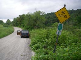 For people headed west,
 this sign is beyond the intersection,
on the right side of the road.
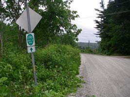 Using the same post for the opposite direction means that for people headed east, the sign is before the intersection,
on the left side of the road.
Economizing on posts.
Sometimes the logic that decodes sign placement is "use the fewest posts, preferably posts that are already there for some other reason." On town roads, sign posts get in the way of snowplowing; often towns allow Cross Vermont signs only if they are grouped on preexisting posts. On trails, having a lot of posts creates clutter (and is expensive.) Grouping signs on the same post can become the deciding factor in things like whether or not they are before or after an intersection, and which side of the traveled way they are on. (See the example in photos to the left.)
How come I keep passing signs that say "Bike Route End", "No Outlet" and "Not a Public Highway"?
Any place a sign like this appears along our designated route, you will also see a Cross Vermont Trail sign saying in essence "yes, and the Cross Vermont Trail keeps going."
- "Bike Route End" means "beware, something about the route up ahead is not in compliance with Federal Highway Administration specifications for Bike Route." You will see a lot of these signs where paved bike paths junction with automobile roads. You will also see them where painted bicycle lanes end along roads. These signs never mean that the bicycle cannot continue beyond the sign. They just mean to be aware that, beyond the sign, the route is transitioning to a different character.
- "No Outlet" shows up on the Cross Vermont Trail where an automobile road dead ends, but an off road trail continues beyond.
- Some old "Not a Public Highway" signs are still in place along the former Montpelier - Wells River Railroad bed. They mean to say that that segment of the railbed is not a road (but is open as a public trail where signed as such with Cross Vermont Trail signs.)
5. Have a good trip.
And tell us how it went. Never hesitate to let us know if you see a spot where the signs should be adjusted, or the written guide clarified.
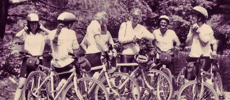 Members of the North American Greenways Tour prepare to navigate the next leg of their journey on the Cross Vermont Trail.